Showing posts with label Bay of Fundy. Show all posts

Tuesday, May 10, 2022

DEATH IN THE BAY OF FUNDY: Things most of us don't see or know about.

DEAD ZONES

The following underwater videos were taken about 10 years ago. They show dead and dying zones in the St. Croix River Estuary adjacent to Bayside Port and Quarry. The cause? Probably a combination of local quarry activities and a 10 year period where the pulp mill in Woodland dumped highly toxic black liquor into the river. 

Odds are this was never acted upon and was ignored by all levels of government.

1. The "normal" look of the bottom where currents prevent sedimentation,


Tuesday, January 25, 2022

ART - Quoddy Memories at Fine Art America

Images created over a 50 year period featuring the Passamaquoddy Region of the Bay of Fundy on the border between Maine and New Brunswick.

Art MacKay images at


Sunday, August 8, 2021

LOOKING BACK: The Phalarope is Fundy's "canary" ... is it dead or dying


This article was written 20 years ago. During that time right whales have moved northward and the presence of Phalaropes has been "up and down" according to the few reports we have received. Is anyone aware of recent studies?


Tuesday, April 14, 2020

EXPLORE: The Strange Rocks of Campobello Island, Bay of Fundy


Some of Campobello‘s young people like to call the ledge off the island’s Liberty Point “Frog Rock.” Some also see the image of a turtle.


With a little imagination, the image of the stone stack below Campobello’s Friar’s Head reveals an “Old Friar.” A Passamaquoddy legend speaks of the stack as a young Indian maiden, turned to stone while awaiting the return of her lover. The cracks in the “Old Friar” indicate he is likely to loose his head in the not too distant future.

Sunday, October 20, 2019

SHIPWRECKS: A collection of old newspaper articles

Facebook has recently added the ability to add group posts to "topics" ... basically categories. This adds a whole new dimension to the value of some FB sites. Here's a booklet I created from Cathryn MacKay's old Fundy shipwreck posts.


Tuesday, October 8, 2019

SEA RISE IMPACTS AROUND THE BAY OF FUNDY - 2.5 - Grand Manan Island


The world’s leading climate scientists have warned there may be only a dozen years for global warming to be kept to a maximum of 1.5 C, beyond which even half a degree will significantly worsen the risks of drought, floods, extreme heat and poverty for hundreds of millions of people.. If so, the estimate on the right side would apply. Subscribe by email to get new posts on this subject. 

It is generally thought that tidal range may stay the same (20 - 50 feet in the Bay of Fundy), but that the cycle range will rise causing flooding to remain on land for a longer period and increasing risk of damage to coastal facilities.

Saturday, October 7, 2017

GRAND MANAN: Tuna, sharks and whales ... fishing in 1934

Southern Weirs Hold the Record
Ten tuna fish were taken from the "Dock" weir at Flagg's Cove one day recently, and several more on other occasions, it is said. The first tuna caught were shipped to Portland but the venture did not prove remunerative enough to the shippers due to excessive transportation charges. The tuna more recently taken were given away to neighbors of the weir owners, and those who liked the flesh enjoyed a feast indeed. North Head weirs are noted for their catching of big fish, and recently another large shark was taken in the same weir which produced a monstrous shark some time ago, the liver from which filled a dory. These weirs, however, are just a whit behind those of the southern part of the parish. A good sized whale was taken in the "Big Weir'' located at Inner Wood Island not long ago. The mammal was killed and towed from the weir by Captain Harry Harvey and crew of the Wood Island Life Saving Station. Whales or sharks, however, it's all in the day's work for the weir fishermen who rarely express surprise at anything they find inside the enclosures. (St. Croix Courier 1934)

GEOLOGY: Old 1872 Grand Manan Copper Mine reopened in 1964


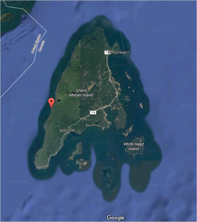
A Toronto group who have been diamond drilling and prospecting on the Island since early spring recently opened the entrance to the old copper mine at Sloop Cove on the Western side of Grand Manan. This mine opened in 1872 by British interests actually operated for a short time with the ore shipped by sailing vessel to England where it was processed. It was said at the time that the ore was of a very high copper content. After a few ship loads operations ceased, no one seems to know why, probably due to dwindling demand at that time. The mine shaft entered the face of the high clifts on Grand Manan's western shore from the beach and it is reported that after removal of the fallen rock blocking the entrance the tunnel was found to be in good condition. Some years ago a number of tools were found on the beach and the older residents remember when the shaft entrance was plainly visible. ( Courier. Oct.8 1964)

REFERENCES:
E. J. CHAPMANREPORT ON THE COPPER DEPOSIT OF GRAND MANAN, BAY OF FUNDY. 
T.O.H. Patrick EXPLORATION OF GRAND MANAN ISLAND FOR KEEVIL MINING GROUP LIMITED , 1964

LINKS:
More information on Grand Manan Geology:
http://earth2geologists.net/grandmanangeology/index.htm

Wednesday, March 15, 2017

WHAT DO YOU THINK NOW? Bay of Fundy Tidal Turbines will Kill Marine Life and Impact Our Eco-economics 2009

ORIGINALLY PUBLISHED IN 2009.
What do you think about this now?

***************************************************************************************************

Turbines perilous to marine animals
SeaGen - world's first commercial tidal genera...Image via Wikipedia
By MICHAEL DADSWELL
Wed. Sep 23 - 4:46 AM

There are misconceptions concerning the turbines that will be used to extract energy from the Bay of Fundy tides and these need addressing. Tidal power from free-running, propeller driven generators is not a free energy gift. There will be environmental costs extracted from the fisheries and tourism of Nova Scotia, which your readers should know.
I have been studying the effects of tidal power on fish and fisheries since 1980 when it became apparent a tidal power plant would be installed at Annapolis Royal. Yes, I am a biologist, but I have consulted with many physical scientists and engineers over the last 29 years during my studies on hydraulic turbines. These include George Baker, an engineer and the former vice president of the Nova Scotia Tidal Power Corporation, who was primarily responsible for the design and construction of the Annapolis Royal tidal power plant. In fact, Mr. Baker funded our work over a period of 10 years because he also wished to know effects of these turbines on fish. What we found was not pretty!

During our studies at Annapolis Royal, we found there was a dramatic impact on the fishes using the Annapolis River estuary. Impacts, which continue today (see blog of the Annapolis Royal Heritage Society Sept. 8, 2009 concerning dead sturgeon found below the generator), were spread across the entire community of fishes.

Francis Jordan asked for the numbers, so here they are. We found that 40 per cent to 50 per cent of the small, out-migrating juvenile fishes (shad, gaspereau, herring, 10 cm long) were killed by turbine passage. Death was mainly by pressure flux and shear around the turbine blades.
Large fishes were mainly injured or killed by turbine blade strike. Experiments with acoustic-tagged adult shad (50 cm long) found that 20 per cent to 25 per cent were killed from a single pass. Larger fishes such as striped bass and sturgeon (one to two metres long) were often found cut in half and many gaspereau, mackerel, flounders, eels and other species were killed or maimed.

Our findings were published in peer-reviewed, scientific journals. If Mr. Jordan does not believe me, then contact the graduate students who worked on the project, many of whom are now university professors or fisheries scientists with the government.

All turbines proposed for the Bay of Fundy and discussed in the environmental assessment released by tidal power proponents in July are generically similar to the Annapolis Royal turbine. They are hydraulic lift turbines that work by Bernoulli’s Principle (which allows airplanes to fly).
Blade design generates lift from the flow of water over them, making the turbine turn and similar physical effects (pressure flux, shear, strike) will occur in these units and harm marine organisms. The problem is there are many more fishes passing through the Minas Channel. They will encounter the turbines more often because the planned turbines will generate in both directions of the tide (Annapolis only generates on ebbing tide), and the open Bay of Fundy contains many marine mammals, including seals and whales with larger body sizes, (two to 20 metres), making probability of blade strike high.

There is little difference between ship propellers and tidal turbines: both work because of Bernoulli’s Principle. The saving grace of ships’ propellers is that most are much smaller than the turbines. If you do the math, a 15-metre diameter tidal turbine turning at the RPMs outlined in proponent’s environment assessment actually have blade tip velocities of 34 to 62 km/h. Few fish or whales can swim that fast and avoid the blades, especially smaller species.
Having said that, every year fish and whales turn up dead on beaches around the Maritimes having been killed by ships’ propellers. Ships may not leave a trail of fish carcasses behind them, but they do kill some of the marine fauna. Ask whale biologists what they think.
My contention is that the large-scale development of tidal power in the Bay of Fundy will do immense damage to the fisheries and whale-watching businesses in the Maritimes. Please remember fisheries and tourism are two of our larger economic engines. Why replace one renewable resource with another when we can obtain it from other sources (wind, solar)? Hydroelectric turbines have done immense damage already to the fisheries resources and tourism of the Maritimes. Remember all the Atlantic salmon rivers we have lost to hydroelectric power generation.

Michael Dadswell is a biology professor at Acadia University
.

FUNDY TREASURES: Pirate Ned Low, Captain Kidd and the Treasure of Isle Haute

FUNDY TREASURES: Pirate Ned Low, Captain Kidd and the Treasure of Isle Haute

by Art MacKay, 3/15/2017


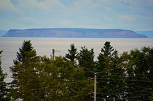
Image taken at low tide at Harbourville, Nova Scotia
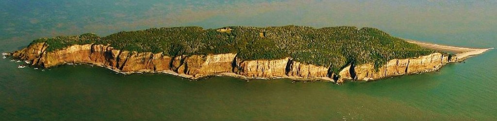
Isle Haute is a remote island in the middle of upper Bay of Fundy near the entrance to the Minas Basin, 16 kilometers from the coast of Harbourville and 8 kilometers south-southwest of Cape Chignecto, Nova Scotia. The island is part of Cumberland County, Nova Scotia and is 3 km long and 0.4 km wide. The Mi'kmaq used the island to make stone tools before Europeans arrived and called the island "Maskusetik", meaning place of wild potatoes. Samuel de Champlain gave the present name to the island, meaning in French "High Island", in 1604 when he observed the towering bluffs, timber and fresh-water springs. The steep 100 m (328 ft) basalt cliffs of the island are the result from volcanic eruptions in the Jurassic period and may have been connected to the North Mountain volcanic ridge on the mainland 200 million years ago, before the Bay of Fundy was formed.
In 1878, a lighthouse was built and was manned until 1956, when fire collapsed the lighthouse and home of the lighthouse keeper. The lighthouse was replaced by a steel tower and is unmanned. Federally owned, the island is being transferred from the Canadian Coast Guard to the Canadian Wildlife Service to protect its unique ecosystem. The island is also protected under Nova Scotia's Special Places Act to protect early Mi'kmaw archaeological sites. Digging without an archaeological permit or removal of artifacts is prohibited. (Modified from Wikipedia)


THE STORY

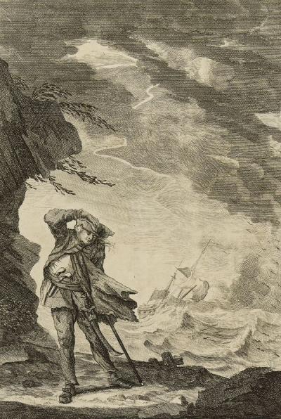
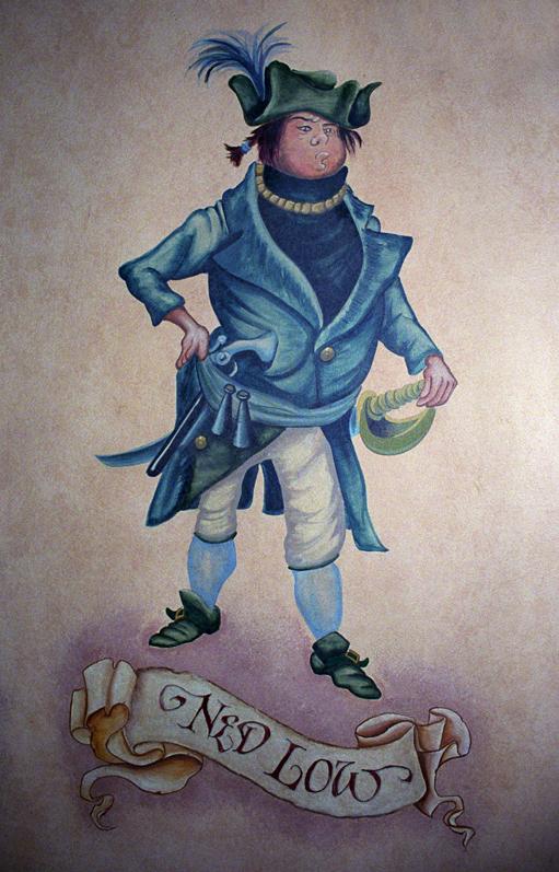
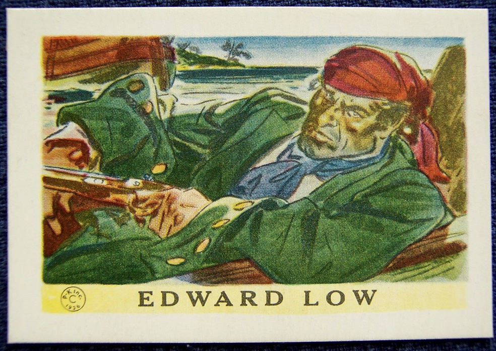
Many of us believe that a mystery unexplained remains a mystery and this seems to be true for Isle Haute, a particularly isolated and rugged island lying off Minas Basin in the Bay of Fundy. While the professionals that study and oversee the island believe that there is no evidence that pirates ever buried treasure there and go so far as to state that “no one has ever discovered any genuine pirate treasure in Nova Scotia”, people still continue the search for treasure left by vicious pirate Edward “Ned” Low or perhaps it was the ubiquitous Captain Kidd as some stories suggest. Whatever the truth, stories abound and treasure hunters have, apparently, pockmarked the island with holes in their quest to discover the treasure. One story places the treasure in a unique pond at one end of the island and it is claimed that there was even an attempt to drain the pond. Islands seem to attract attention as great places to buy and hide ill­-gotten booty and Isle Haute is one of the best.

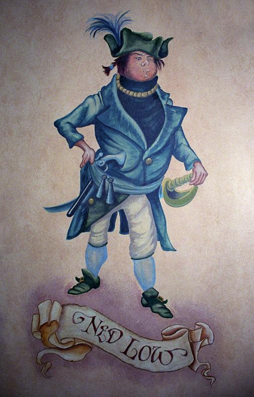
Ned_Low_at_PTOC.jpg

Early stories suggest the Acadians hid their valuables there during the expulsion and then there is Captain Kidd who seems to have buried his treasure everywhere.

But the established history of Captain  Ned Low places him in the Fundy area. “Outrunning his pursuers following a raid on the New England coast, Pirate Ned and his crew arrived in the Minas Channel in 1722. Supposedly, Ned not only buried his booty on Isle Haute, he also sacrificed one of his crew, whose ghost would guard the treasure until Ned’s return. Ned never made it back, however, as he was captured, imprisoned and ended his career at the gallows, taking the secret location with him.” (novanewsnow.com)

In 1929 B.C. treasure hunter Douglas Carmichael made several trips to the island and reported his discovery of “jewels and coins”. His claims were never supported however and the truth of his discover remains unproven. While many years have passed and the individual is long past away, Edward Rowe Snow, an American adventurer and writer learned about the treasure of Isle Haute. He researched the subject and somehow, somewhere, obtained a map that was reputed to have been created by Ned Low himself. The map image clearly resembled Isle Haute and, equipped with his research and a professional metal detector, Snow arrived on the island in 1952 as a guest of the lighthouse keeper, John Fullerton and began his search.   It apparently wasn’t long before he unearthed a human skeleton and in the same area a cache of silver and gold coins some dating back to 1710. His discovery was quickly seized by the authorities but a later application to the appropriate authorities resulted in the return of his coins. The world press picked up the story and he and Isle Haute became famous for a brief time. He published photos of his find in Life magazine, although it is open to question whether what he claimed to have found was treasure, shipwreck gold or merely a plant. Snow was candid in admitting that the real money in treasure hunting came not from finding anything but rather from writing about it and selling books.(see McLellan, 1955; Trueman, 1970; Snow, 1952). Unfortunately, Snow’s efforts and those of other treasure hunters have led to the pointless and frenzied digging on Isle Haute, which hold tragic consequences for the island’s history. The spot most favoured by Snow and other treasure hunters at one end of the pond also happens to be one of the more important archeological sites on the island.

HOW TO GET THERE

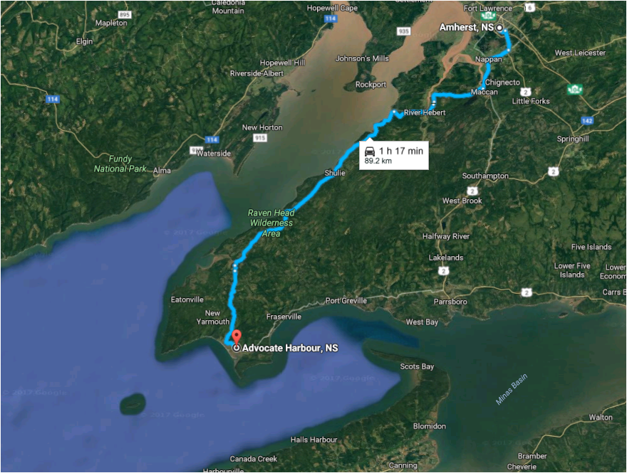
Amherst to Advocate harbour.PNG

IS IT WORTH VISITING?

Beautiful, rugged, remote and inaccessible aptly describe Isle Haute. Originally managed by the Canadian Coast Guard, the lighthouse is long gone and only a tower serviced by a helicopter, guide the ships at night. Today, there is some confusion about who manages the island and Provincial professionals seem to think a permit is required. But at this time, it is uncertain how you apply. That said, a boat tour can be arranged and there are many, many other interesting places to explore, making the trip worthwhile and one that should be on your list.

Isle Haute has all of the elements of a great place to visit and based on all the comments I have seen, it is well worth the effort.  There is only one way really and that is by boat. We recommend you contact Advocate Boat Tours to book you visit. Isle Haute is one of their favourite tours. Here’s part of what they have to say:

all 1-902-670-8314 or email onthebay@advocateboattours.com.
Remote Isle Haute is home to a large seal and seagull colony. Copyright: paulillsley.com
Remote Isle Haute is home to a large seal and bird colony. Copyright: paulillsley.com
Take an off-shore tour to the mysterious Isle Haute in the middle of the Bay of Fundy where numerous seals frolic in the clear water, and bald eagles, seagulls and peregrine falcons ride the updrafts along the cliffs. This destination is the highlight of any trip to Nova Scotia if you like wild, unspoiled nature and amazing geology. Our most popular tour, this is always a hit with the kids as well due to the awesome wildlife viewing opportunities.

IMAGES


Edwardlowepicture.jpg Ned_Low_at_PTOC.jpg

Pirate_Flag_of_Jack_Rackham.svg.png

1936_Low_card.jpg The_Cruelties_practised_by_Captain_Low.jpg
400px-Edward_Low_Flag.svg.png

RESOURCES
The Reference Files: These are the media and document files we use in preparing this guide provided as a single Zip File. It includes general information as well as information on the lighthouse, pirates, shipwrecks of the island, studies carried out and tourist services in the area. We save references as PDFs since we discovered that links tend to disappear taking important information with them. Please note the copyrights remain with the owners and apart from our guide all other media and documents are for references and fair use only. $7.99 Buy this on Selz


REFERENCES


Friday, March 3, 2017

No Marine Protected Area for Quoddy-Cobscook Area. Why is that?


As shown in the attached slide show, the Quoddy - Cobscook Region of the Bay of Fundy is unique.

In fact researchers have identified the area as having the richest biodiversity on the northern coast of the Atlantic and an area that is vital to a large list of threatened and endangered species.

Numerous attempts have been made to industrialize the area stretching back to earliest settlers and developers.  In each and every case, local fishing, tourism and environmental interests have successfully fought to retain the area. Losses still occur through pollution and near-local activities and the future is far from secure.

A recent opportunity to design and create a Marine Protected Area was introduced by the new Federal Government. Meetings were held and pitches were made, but it was clear early on that this area was not up for consideration in spite of the fact that it was mentioned in early press releases.

Why is that? Who or what prevents the protection of this vital area shared by Canada and the United States?

What do you think?

>

Tuesday, May 14, 2013

FUNDING: Community and Business Toolkit for Tidal Energy Development

English: Bay of Fundy © 2004 Matthew Trump
English: Bay of Fundy © 2004 Matthew Trump (Photo credit: Wikipedia)
ATEI is Pleased to Announce Release of the Community and Business
Toolkit for Tidal Energy Development.

Click here
<http://tidalenergy.acadiau.ca/community-business-toolkit-.html>to learn
more and download a
copy (http://tidalenergy.acadiau.ca/community-business-toolkit-.html


In June 2011, the Nova Scotia Utility and Review Board (UARB) announced
Community Feed-In Tariffs (COMFIT) for various renewable energy
developments, including small-scale tidal energy. This innovative
government policy gives communities/developers a long-term, guaranteed
price for electricity generated from renewable resources. The UARB also
announced that feed-in tariffs for large-scale tidal energy would be
forthcoming.

However, many question remain around how communities and businesses in
Nova Scotia can benefit from tidal energy development. To address some
of these questions the *Acadia Tidal Energy Institute,* with support
from municipal, provincial and federal partners, has developed the
*Community and Business Toolkit for Tidal Energy Development.* The*
Community and Business Toolkit for Tidal Energy Development *will assist
communities and businesses in better understanding the opportunities
stemming from tidal energy while encouraging responsible harvesting of
the tidal energy resource.

The* Community and Business Toolkit for Tidal Energy Development
*contains a series of modules that describe opportunties and strategies
for communities and businesses to become involved in tidal enegy
development. The modules also provide relevant advice, checklists and links.

*The Entire Toolkit and Individual modules can be downloaded from the
links below.*

Dana Morin
/Director-Business Development/**
*Fundy Tidal Inc.*
121 Second Street
Westport, Nova Scotia, B0V 1H0
Office: (902) 839.2078
Cell: (902) 790.3565
www.fundytidal.com <http://www.fundytidal.com/>

*Marine Renewables Canada, www.marinerenewables.ca <www.oreg.ca>*

/Aligning industry, academia and government to ensure that Canada is a
leader in providing ocean energy solutions to a world market.
/*Fundy Energy Research Network (FERN), fern.acadiau.ca
*/Fostering Collaborations in Tidal Energy Research/

Tuesday, February 12, 2013

Glasgow Steamer Hestia lost off Grand Manan - October 1909

Get the pictures and subscribe at: http://fundytides.blogspot.com

Hestia porthole. Art MacKay


Bay of Fundy, NB Steamer HESTIA Lost, Oct 1909 Posted April 21st, 2010 by Stu Beitler
From: Gendisasters

GLASGOW STEAMER LOST.

THIRTY-FOUR MEN DROWNED IN THE BAY OF FUNDY.

SUFFERINGS OF SIX SURVIVORS.

The Glasgow steamer Hestia was wrecked on Grand Manan Island, in the Bay of Fundy, New Brunswick, in a storm on Monday, and thirty-four of those on board were drowned, only six being saved. There were five passengers on board, all of whom appear to have been drowned.
The vessel, says a Reuter telegram from East Port, Maine, ran on to a shoal at Old Proprietor Ledge, her bows were impaled on a rock, and her after part, swinging free, was tossed high by the heavy seas. The captain had the boats lowered at the first shock, and as the vessel heeled over, and great waves swept her deck, the work was exceedingly difficult. In one of the boats four Scottish boys who were passengers were placed, with twelve of the crew. The boat, however, capsized, and all were drowned except two of the men. Still another boat was lowered, in which the captain took his place, with all the rest of the crew except six, who were left on board. When the gale abated in the afternoon the six men left on board were rescued by lifeboats. These, says a Lloyd's telegram, are the third officer (STEWART), the second engineer (MORGAN), and four seamen, KEEN (?Brian), McKENZIE, SMYTH, and McVICAR. The Hestia is a total wreck.

Three of the boats drifted ashore on Wednesday; two were empty, and the third contained four dead bodies.

38 Hours In The Rigging.
The third mate gives the following particulars:
The discovery of the ship's plight from the shore was delayed by thick weather. The survivors were lashed to the rigging for thirty-eight hours without either food or water, and when they were taken off by the lifeboat their condition was pitiable. Their sufferings were so terrible that it is feared that one of their number will not recover. After they had been in the rigging for twenty-four hours there were indications that caused them to fear that the mast would fall, and they therefore changed their position, working their way slowly and cautiously to the bridge, which was still out of water. It was, however, so exposed to the seas breaking over the vessel that they were obliged to return to the rigging.

Crew Of Clyde Men.
It is supposed that the vessel was misled by a wrong light, with the result that she was carried miles out of her course. She left Glasgow for St. John's, New Brunswick, on October 10th, with a crew of thirty-five, five passengers and a general cargo.

All the crew were shipped at Glasgow, and were chiefly Clyde men. The four Glasgow boys reported drowned were on their way to Canada in charge of horses with which to start farming.

The list of crew and passengers is as follows:
Captain H. M. NEWMAN.
First Officer T. McNAIR.
Second Officer JOHN McPHUN.
Third Officer S. STEWART.
Carpenter WILLIAM CALDWELL.
Boatswain ALEX DUNIGAN.
A.B.'s JAMES SMYTH, JOE SMYTH, B. BRIAN, A. MURRAY, C. McVICAR, D. GIBSON, JOHN McKENZIE, and WILLIAM CANDLESS.
Ordinary Seaman D. SINCLAIR.
Chief Engineer P. F. MUNN.
Second Engineer A. MORGAN.
Third Engineer H. SCOTT.
Fourth Engineer W. S. BEST.
Donkeyman HUGH SPIERS.
Storekeeper W. WARNOCK.
Firemen CHARLES DOEHERTY, P. HANNAH, JAMES RODGER, A. DUBRAN, A. MARTIN, and JOHN DONOCHIE.
Trimmers DANIEL CLARK, JOHN McFARLANE, DAVID McLEON, and JOHN O'NEIL.
Chief Steward A. McLEAN.
Second Steward A. GRAHAM.
Cook R. LAVERY.
Assistant Steward W. HART.
Passengers, JAMES WELSH, JAMES GALLOWAY and R. GALLOWAY (brothers), T. REID and D. COWAN.

The Hestia was a steel screw steamer of 2,434 tons, built in 1890. She belonged to the Donaldson Line of Glasgow.

Hackney Express Middlesex London 1909-10-30

Thursday, November 10, 2011

NUCLEAR: Unanswered questions about Point Lepreau Nuclear Generating Station.


Dateline: Bay of Fundy, November 10, 2011.

As the 7 natural wonders hype about the Bay of Fundy begins to die down with the closing of the 7 wonders contest, it is time for all Canadian citizens to address the darker issues of the Bay of Fundy and to move towards greater protection of Canada's number 1 natural treasure. Among those darker concerns is the Bay of Fundy's nuclear presence.

As the refurbishment of the Point Lepreau Nuclear Generating Stations continues to plod along while sucking up millions more of the taxpayers money, the media seems strangely quiet even while the lobby for decommissioning of this facility continues ...  unfortunately with little apparent public support. It is odd indeed that the most sinister development in the Bay of Fundy draws little or no concern from the average citizen.

With the continuing nuclear disaster in Japan and the horrendous impacts globally to our air, earth, and water, don't Maritimers have the slightest concern about the refurbishment of a rickety old Candu reactor that sits right on friable shale on the Fundy fault block? Do we not, at least, have questions that need to be answered?

Well,  Willi Nolan of the International Institute of Concern for Public Health (IICPH) has been asking these questions for some time now. Addressed to the Canadian Nuclear Safety Commission (CNSC) during a “CNSC 101 Information Session for Stakeholders” which was held on June 23, 2011 at the Hilton Convention Centre in St. John, New Brunswick, the questions were sent to the CNSC Directorate of Nuclear Cycle and Facilities Regulation in July, 2011. CNSC responded to some of these and other questions on November 9, 2011. They are all listed at http://nb.referata.com/wiki/FAQ_Canadian_Nuclear_Safety_Commission . You will note with interest I am sure, that many answers remain pending.

IICPH provides information about the dangers of Point Lepreau and is fighting for the decommissioning of this old and dangerous plant. You can learn more at: http://iicph.org/tag/lepreau